
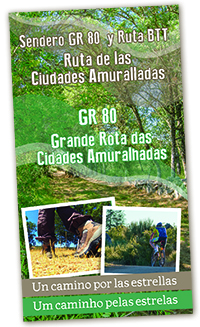
Image of the brochure’s
cove |
|
The 110 km trail running
between the walled
cities of Ciudad Rodrigo
(Salamanca, Castilla y
León, Spain) and Almeida
(Beira Interior Norte,
Portugal) provides an
opportunity to discover
on foot, by bike or on
horseback, lands with an
abundance of natural and
cultural resources. The
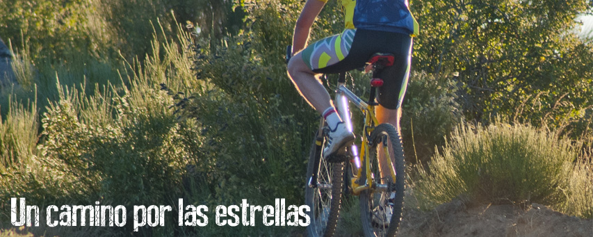
star-shaped layout of
the military
fortifications in the
area lies behind the
route’s slogan: a
journey through the
stars.
Following paths that in
centuries past were
travelled by armies,
peace now reigns on the
route and enables us to
quietly enjoy the
landscapes of these
frontier lands. Both the
variations in the
physical environment
itself and a traditional
form of human occupation
have led to the
preservation of
considerable
biodiversity.
The cultural heritage is
also outstanding. The
fortified bastions of
Ciudad Rodrigo, Almeida
and Aldea del Obispo
provide an exciting
array of military
architecture. The route
also passes by the
prehistoric rock-art
site - Estación de Arte
Rupestre - of Siega
Verde, declared a World
Heritage Site together
with the nearby site of
Vale do Côa (Portugal).
TECHNICAL
DATASHEET
Overall
length:
110 km
Total time
on foot:
6 days - 19
h
Total time
by bike:
1 or 2 days
-9 h
Circular
route.
On foot, by
bike, or on
horseback
Average
difficulty
(MIDE 2):
Long, gentle
slope. The
trail is
generally
wide
Cumulative
elevation
gain:
1,270 m
Altitudes:
Maximum, 794
m. Minimum:
610 m
Recommended
gear:
Boots,
drinking
water, and
cap or hat
Recommended
times of the
year:
All the year
round.
Not
recommended
in heavy
rain.
Considerable
precaution
is to be
taken in
winter due
to severe
frost and/or
snow
Coordinates:
Almeida, N40
43.331 - W6
54.325.
Ciudad
Rodrigo, N40
35.892 - W6
32.140
Accesses:
Portugal:
A25/EN 332.
Spain:
A62/N-620
|
Equipment
MTB maintenance areas.
Both Almeida and Ciudad
Rodrigo have respective
bike support facilities,
fitted with an
information panel, a
point for downloading
digital information (tracks
for GPS), repair tools,
and washing and
showering facilities.
Infrastructure
Several small bridges
have been built across
some of streams with
wooden structures
treated for all-weather
conditions.
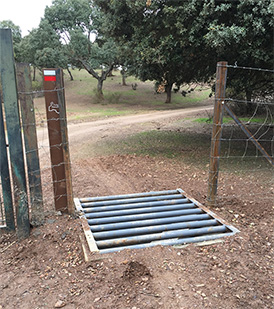
When the trail passes
through some private
estates, small cattle
grids have been
installed, with a
standard gate beside to
allow cattle to pass
through if necessary.
Some of the rougher
stretches have been
provided with a selected
clay surface,
guaranteeing a minimum
trail width of 1 m.
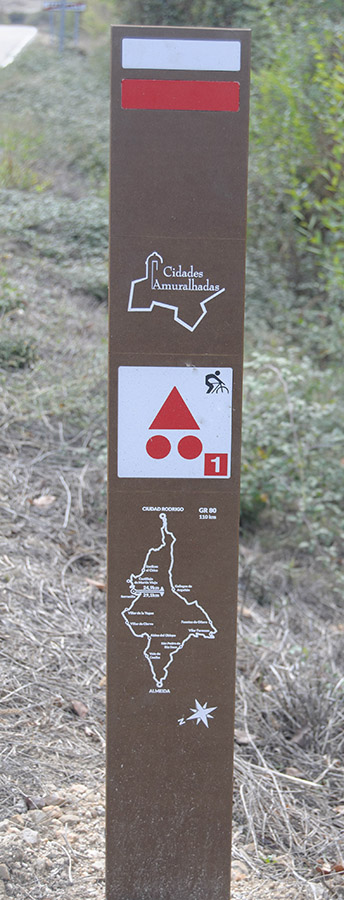
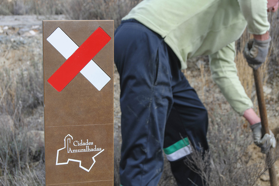
SIGNS AND
PUBLICATIONS
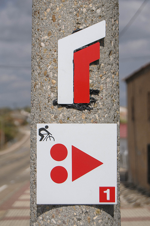
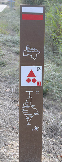
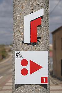
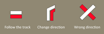
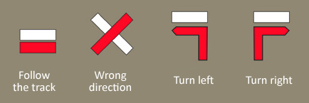
Direction signs
These are mounted on
posts made of a phenolic
compound, placed mainly
at crossroads. Some of
them have a map
indicating the exact
location and the
distance to Almeida and
Ciudad Rodrigo,
respectively
In other cases, these
direction signs are
stickers and painted
marks.
GR trail in Spain:
GR trail in en Portugal:
MTB Centre (for bikes):

Information and
interpretation panels
There are 12 vertical
panels set up along the
trail. They have BiDi or
QR codes that provide a
link to this website.
Two of these panels are
located in the bike
support facilities in
Almeida and Ciudad
Rodrigo, respectively.
They feature a map of
the entire route and
information on the trail
and the main sites worth
visiting. They show the
stages for walking the
path on foot and the
profiles for each one of
them. They also provide
information on services.
The other 10 panels are
to be found at the
following points: two in
Ciudad Rodrigo (North
exit and South exit),
and one each in Gallegos
de Argañán, Fuentes de
Oñoro, Vilar Formoso,
São Pedro de Rio Seco,
Almeida, Vale de Coelha,
Aldea del Obispo and
Villar de la Yegua.
These panels provide
information on the main
natural and cultural
resources we can
encounter beside or near
the trail.
Publications
A folding pocket map has
been published, which
besides the map itself
contains all the
essential information
for enjoying the route.
A BiDi code provides a
link to this website.
|